Words and photos by guest blogger and former Cascadia student Dash Paulson. Adapted from an arcGIS story map at https://arcg.is/1TmjOK
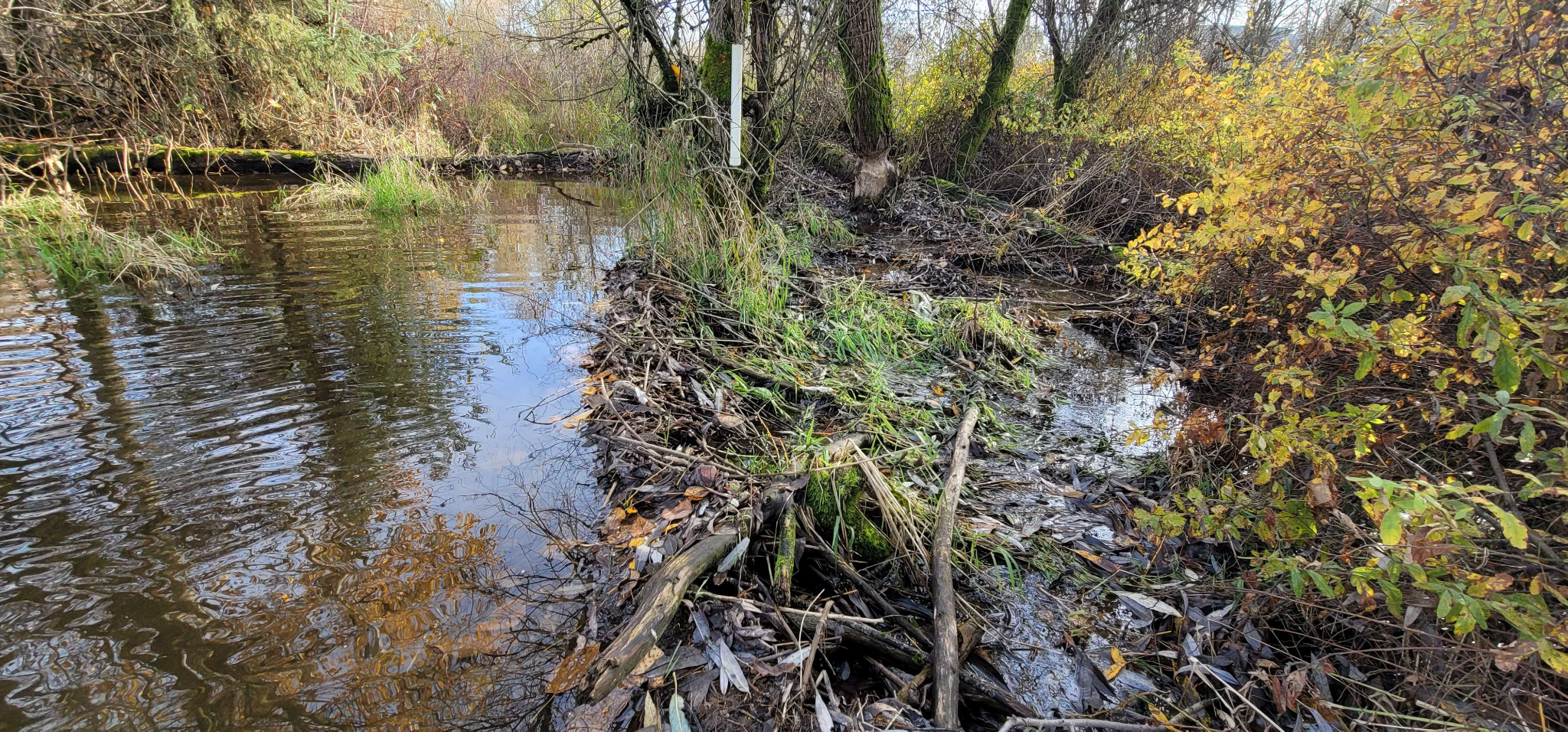
The shared campus at the University of Washington Bothell and Cascadia College has a secret. Just beyond the athletic fields and campus farm, a lush green wall of willows, salmonberry, and red-twig dogwood marks the edge of one of the most complex and successful wetland restoration projects in the history of Washington: the North Creek wetland. Between 1997 and 2002, the Washington State Higher Education Coordinating Board worked with professors and restoration practitioners to restore 58-acres of degraded pasture land into a floodplain wetland that now teems with hundreds of plant and animal species. Among those inhabitants, beavers have emerged as key players in shaping this watery urban wilderness.
The vegetarian beavers are more than residents; they are ecosystem engineers. Their tree-cutting and dam-building activities create large, shallow ponds that store water and mitigate drought and floods. These aquatic habitats also improve water quality by slowing down sediment and pollutants that fall out of suspension and become trapped in the soil. Beaver habitat creation provides habitat for dozens of species of plants, insects, amphibians, fish, and waterfowl. In our increasingly urbanized world, the presence of beavers in places like the North Creek Wetland is a hopeful example of nature coexisting alongside human development.
Last September, I teamed up with the campus Grounds and Wetlands Operations team to monitor beaver activity in the wetland. Besides trekking into the wetland to make ground observations, I’ve used drones to capture the seasonal changes of the wetland and deployed wildlife cameras to study the beavers behavior. In late May, I found the beavers doing something completely new….
Dam Good Fun!
Friendly games of wrestling and shoving may help Beavers learn defense skills
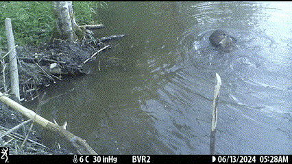
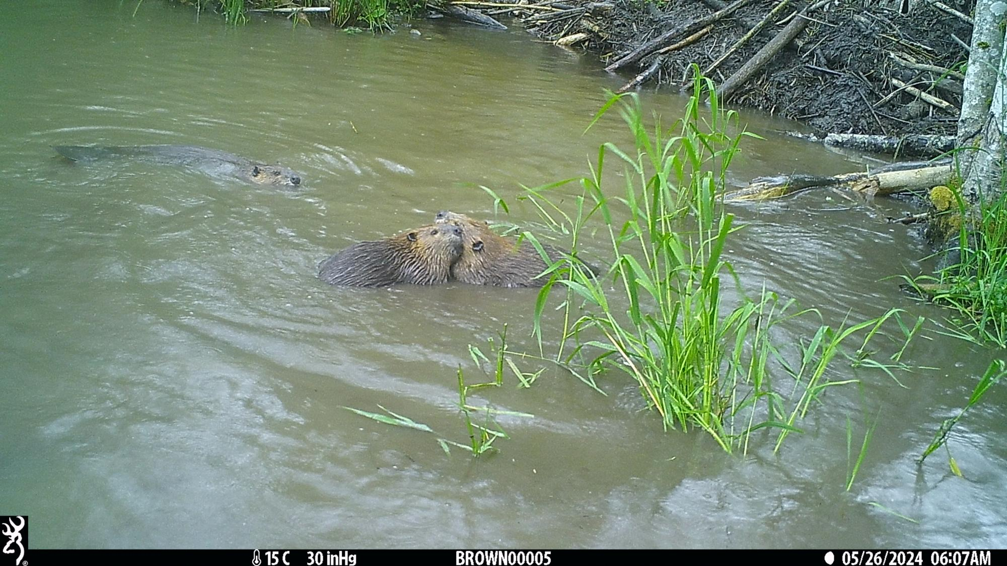
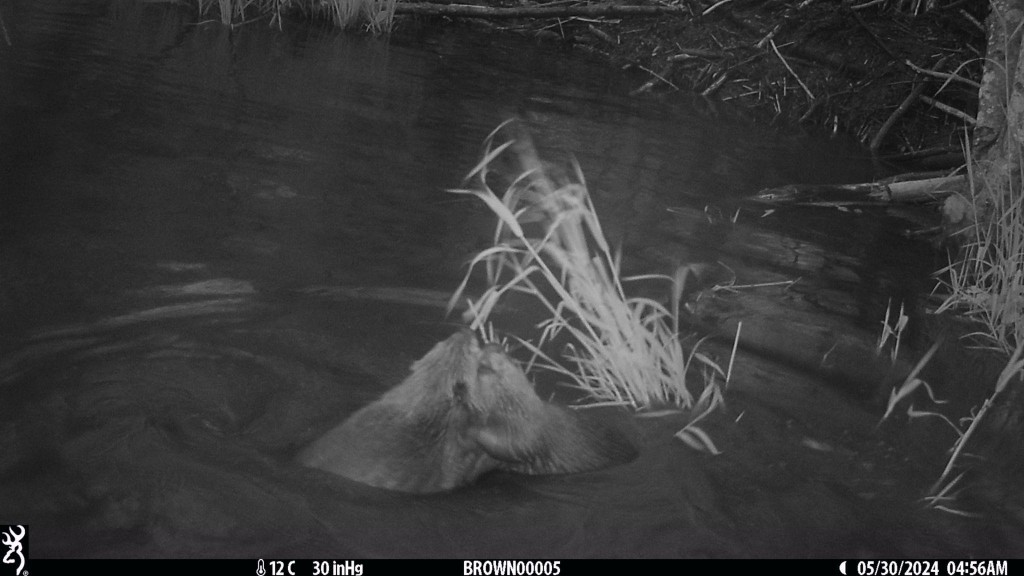
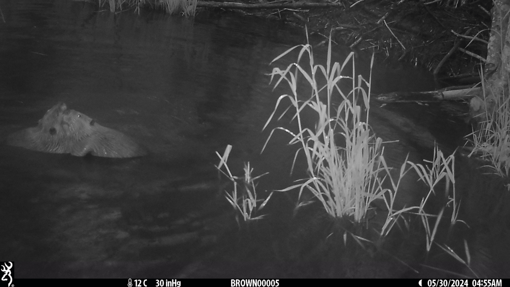
What are these two beavers in the North Creek wetland doing? They seem pretty close and the water is cloudy from sediment.
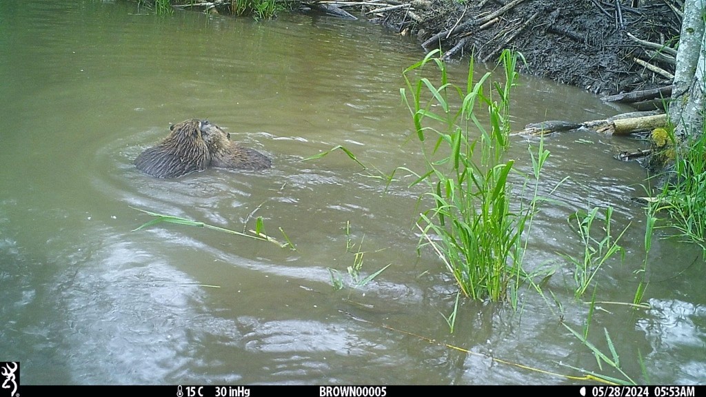
It looks like a wrestling match! 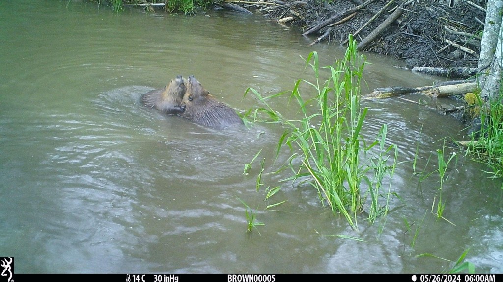
Or perhaps a dance? Even though their orange teeth are bared, this is a friendly game. Beavers (Castor canadensis) only bite when defending their lives or family territory (Rosell and Campbell-Palmer 2022).
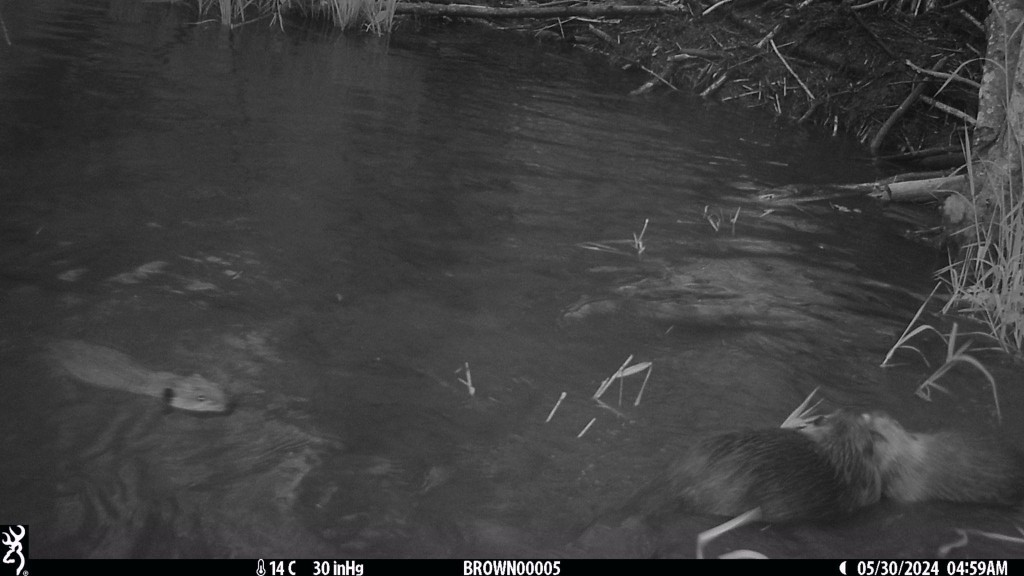
A smaller beaver, probably a yearling related to these two, swims around the action, keeping an eye on these early morning contests of strength.
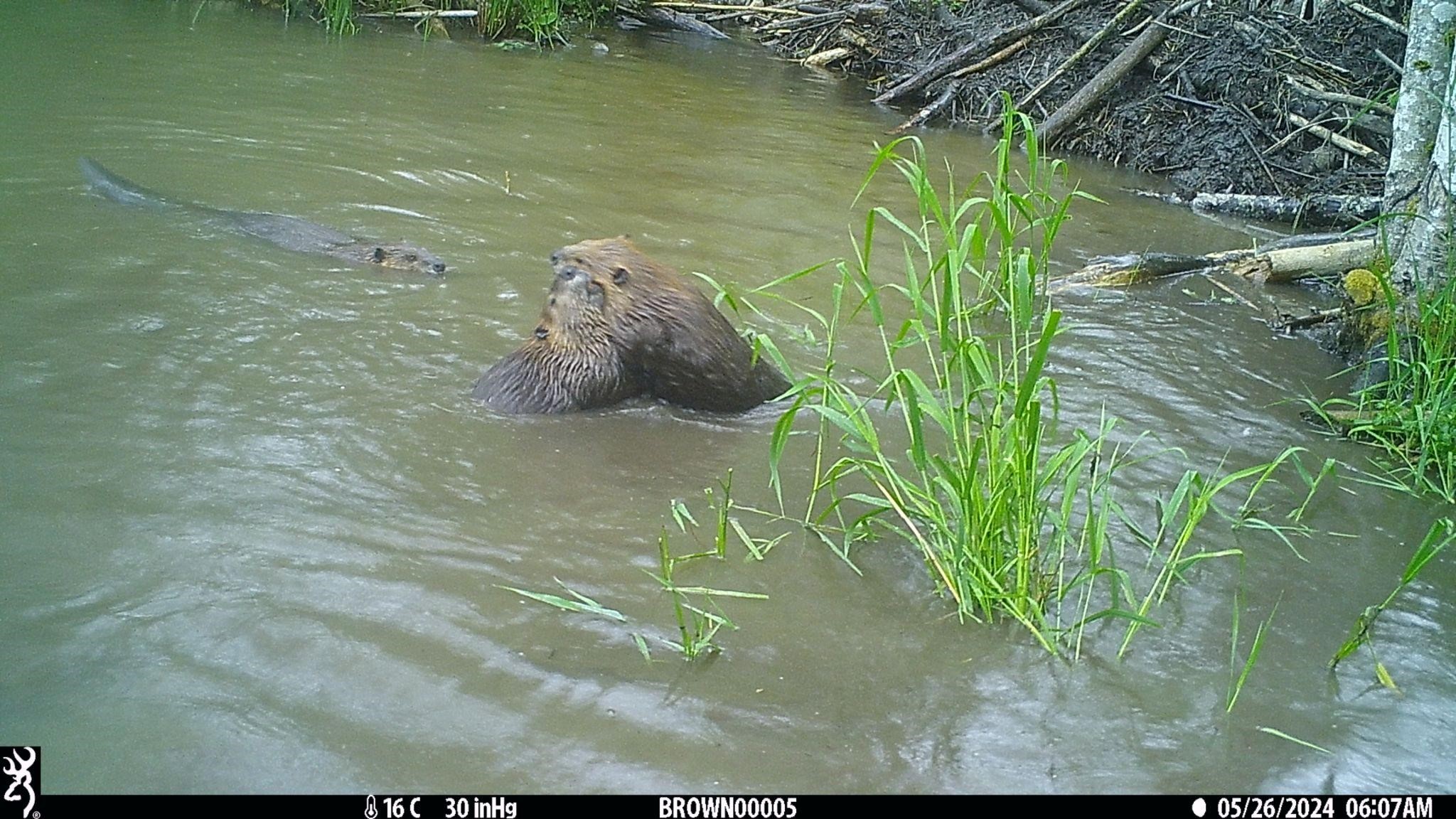
These two will push each other around in circles, all over the shallow pond in front of the family lodge.
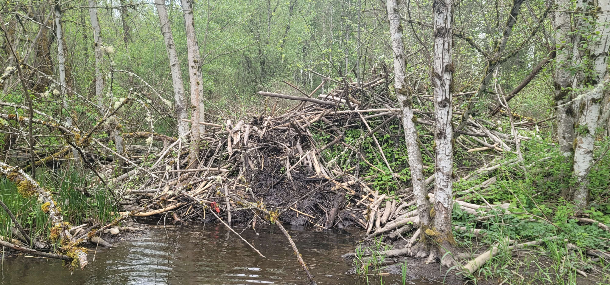
The beaver’s family lodge is more than 7 feet tall, surrounded by water on three sides, and continually repaired and added onto. A stand of young Oregon Ash (Fraxinus latifolia) grow through the lodge, perhaps acting as support beams for the mighty beaver fort.
Beaver families can include 2 to 12 related individuals and often include kits (0-1 years old), yearlings (1-2 years old), and parents (Rosell and Campbell-Palmer 2022). They can also include grandparents, brothers, sisters, and in-laws! Beavers will usually live up to 12 years old in the wild (WDFW), but some beavers have lived up to 30 birthdays living in captivity (Smithsonian 2016).
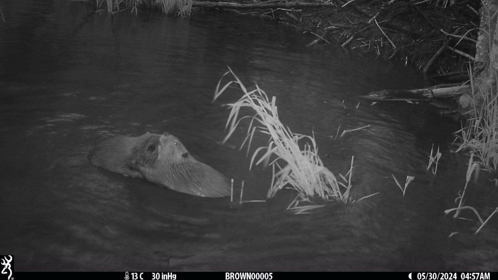
Almost every morning between May 26 and June 13, 2024, the beavers square off in a pushing match, usually starting just before 6 AM. The action is captured by motion activated Browning 2019 camera traps, set out to monitor the beaver’s activities in the wetland. When the match begins, the sun has barely risen. In the wan light, the camera flashes bursts of infrared light, invisible to human and beaver eyes, to illuminate the scene and capture a black and white image. It might seem early, but these games occur at the end of the beaver’s working day. Most beaver families are nocturnal and crepuscular (active at twilight) so they only start getting busy when the sun goes down.
These two will push each other all around the front yard of the family lodge and can keep at it for at least 5 minutes without a break! According to “Beavers: Ecology, Behaviour, Conservation and Management” these playful shoving matches help prepare younger beavers for when they need to leave the lodge, usually when they’re 2 to 3 years old. All this wrestling and pushing helps them build muscle and learn the right combination of moves to win in a fight with another beaver over territory.
References
- Rosell, Frank, and Roisin Campbell-Palmer. Beavers : Ecology, Behaviour, Conservation, and Management. Oxford, Oxford University Press, 2022.
- Smithsonian National Zoo & Conservation Biology Institute. 2016 Apr 25. Beaver. Smithsonian’s National Zoo. https://nationalzoo.si.edu/animals/beaver.
- Washington Department of Fish and Wildlife. “Beaver | Washington Department of Fish & Wildlife.” Wdfw.wa.gov, wdfw.wa.gov/species-habitats/species/castor-canadensis.
This work was done by Dash for the UW Wetland program. Cascadia is funded by King County Water Treatment Division. Dash’s work is featured here as a connected partner for our campus! We appreciate their ongoing support, and encourage you to look into learning about stormwater, wetlands, ways to manage your own home, and help in the community!


